In recent years, the utilization of pedestrian flow data has been gaining attention in regional revitalization. Understanding current pedestrian flow is crucial for effectively guiding tourists and residents to attractive regional spots, maximizing the area’s appeal. The availability of large-scale GPS location data from smartphones has enabled the identification of specific movement patterns. However, these data provide a broad overview but often have limited time granularity and lack detailed movement destination data necessary for simulating pedestrian flow, presenting challenges in capturing detailed patterns within specific areas. This study explores a method to simulate pedestrian flow within an area of approximately 1 square kilometer by estimating pedestrians’ origins and destinations (OD) using GPS location data, which is low in temporal resolution but available over vast areas.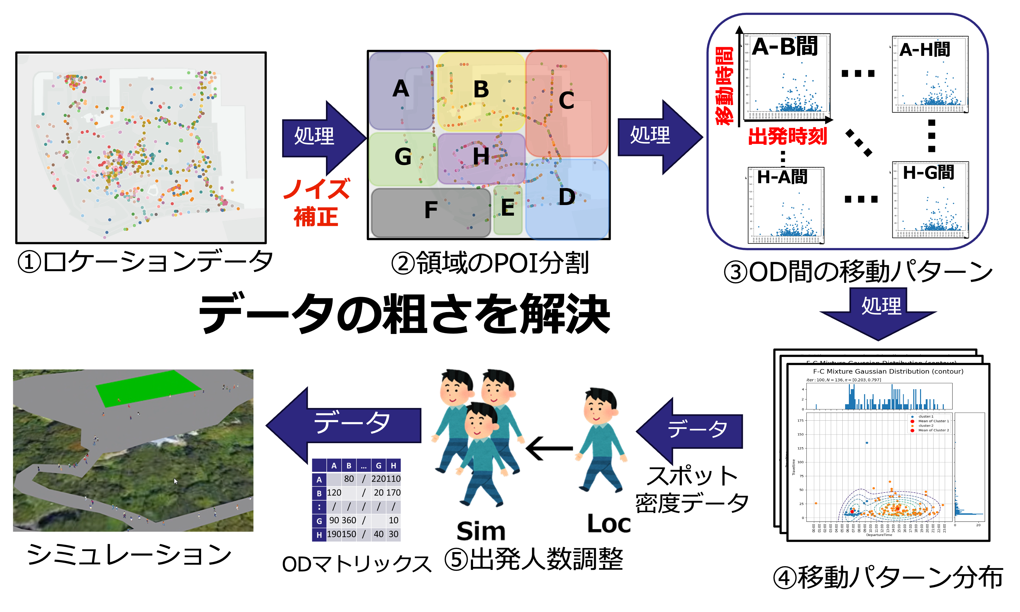
Published Papers
- 上垣雅史, 天野辰哉, & 山口弘純. (2023). 広域ロケーションデータとスポット通行データの融合による人流再現手法の検討. 研究報告高度交通システムとスマートコミュニティ (ITS), 2023(23), 1-8. https://ipsj.ixsq.nii.ac.jp/records/229024
- 上垣雅史, 天野辰哉, & 山口弘純. (2024). 広域ロケーションデータとスポット通行量データの併用によるシミュレーション上への歩行者流再現手法. マルチメディア, 分散, 協調とモバイルシンポジウム 2024 論文集, 2024, 1109-1116. https://ipsj.ixsq.nii.ac.jp/records/240266
- Masashi Uegaki, Tatsuya Amano, Hirozumi Yamaguchi, "Simulating Urban Pedestrian Flows by Fusing Wide-Area Location Data and Spot Pedestrian Counts" In Proc. of the EAI MobiQuitous 2024- 21st EAI International Conference on Mobile and Ubiquitous Systems: Computing, Networking and Services,


