Smart City Technologies
We are pursuing technologies for modeling and understanding the mobility of people and vehicles in the real world
Smart Mobility
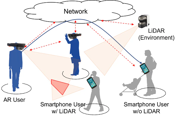
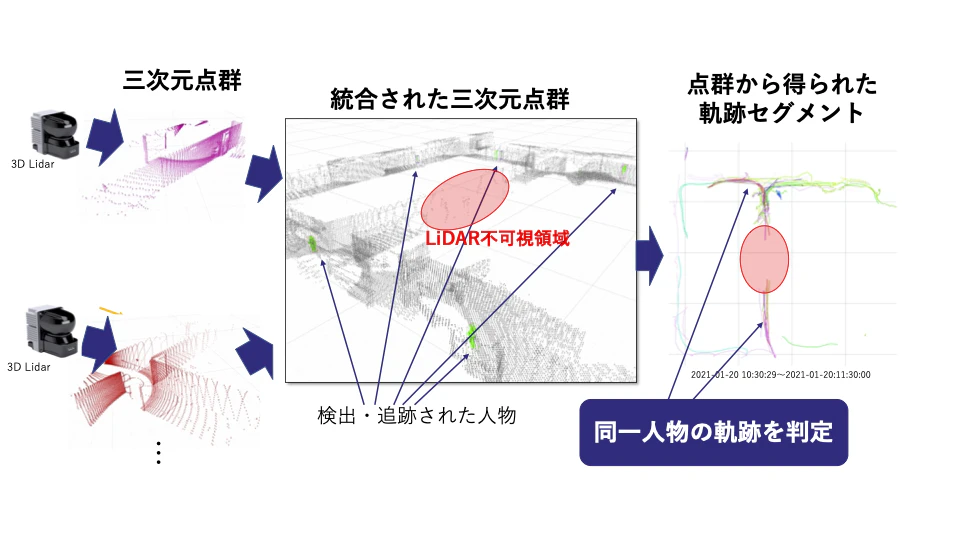
Pedestrian tracking has become increasingly important in recent years to realize human-centric applications such as crowd navigation, facility design, evacuation planning, and path analysis. We propose a novel system that simultaneously tracks pedestrians and crowds using a laser range scanner (LiDAR). When the crowd density is not relatively high, the proposed system accurately captures the movement trajectory of each individual to achieve granular path analysis, while when the crowd density is extremely high, the system automatically switches to an algorithm that accurately estimates the number of pedestrians in the area. In addition, by capturing and sharing indoor human behavior and social information with LiDAR and multiple smartphones, "personal + crowd + social" navigation can be realized, and demonstration tests are ongoing in a commercial building in Osaka.

Map-Aware Super-Resolution GPS Trajectory Reconstruction via Machine Learning
Mobility Data Reconstruction, Spatial-Temporal Data Processing, Transformer Models, Graph Neural Networks (GNNs), Map-Matching Algorithms

Understanding Visitor Mobility Patterns in Public Spaces: A Case Study of Wakayama Castle Park
Visitor Mobility Patterns, Wakayama Castle Park, Reconstruction of Mobility Trajectories, Statistical Analysis,Counterfactual Analysis,Accessibility Constraints,Environmental Conditions,Decision-Making Processes,Design of Mobility Services

Interpretable Environmental Condition Recognition for Autonomous Driving Using Surrogate Decision Trees
Autonomous Driving, Environmental Condition Recognition, CNN, Surrogate Model, Decision Tree

Traffic Safety Assistance System for Electric Scooters
Electric Scooter (E-Scooter), Micromobility Traffic Safety, Edge Computing, Real-Time Hazard Prediction, Route Recommendation, Safety Assistance Systems

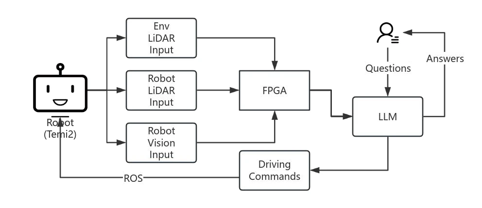
LLM-Driven Adaptive Autonomous Robot Navigation via Multimodal Fusion for Dynamic Environments
Autonomous Navigation, Multimodal Fusion, FPGA Acceleration, LLM (Large Language Model), Socially Compliant Path Planning, Dynamic Environment Adaptation

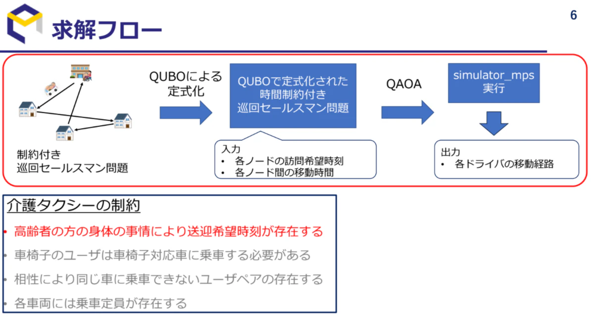
Quantum Approximation Method and Neural-Integrated Mathematical Optimization Algorithm for Elderly Care Taxi Dispatch Problem
Quantum Computing, Combinatorial Optimization, QUBO, QAOA, Multi-Person Time-Window Constrained Traveling Salesman Problem, TW-TSP, Quantum Approximate Algorithm, Unconstrained Quadratic Optimization Problem, Graph Neural Network, GCN, Vehicle Routing Problem

Lightweight Merging Point Prediction on Highway On-Ramps Using Regression Techniques
Driver Assistance Systems, Multi-autonomous Vehicle Studies, Models, Techniques and Simulations, Automated Vehicle Operation, Motion Planning, Navigation

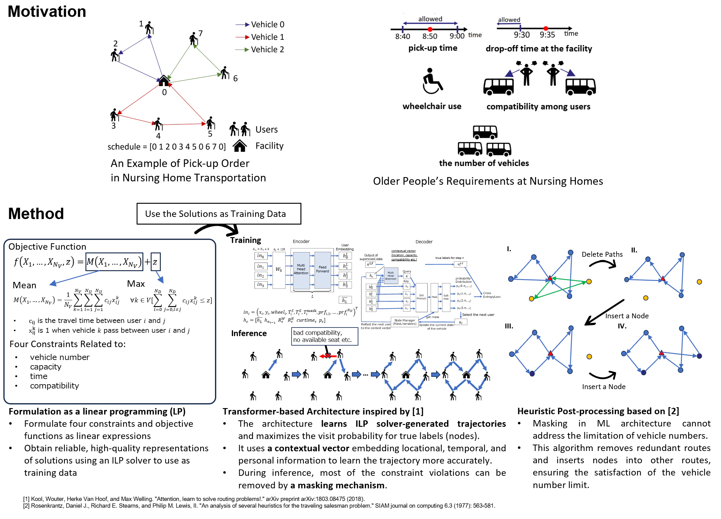
Optimizing Nursing Care Taxi Dispatch Leveraging Integer Linear Programming Solvers and Machine Learning
Vehicle Routing Problem, Optimization, Integer Linear Programming, Machine Learning, Supervised Learning, Smart City

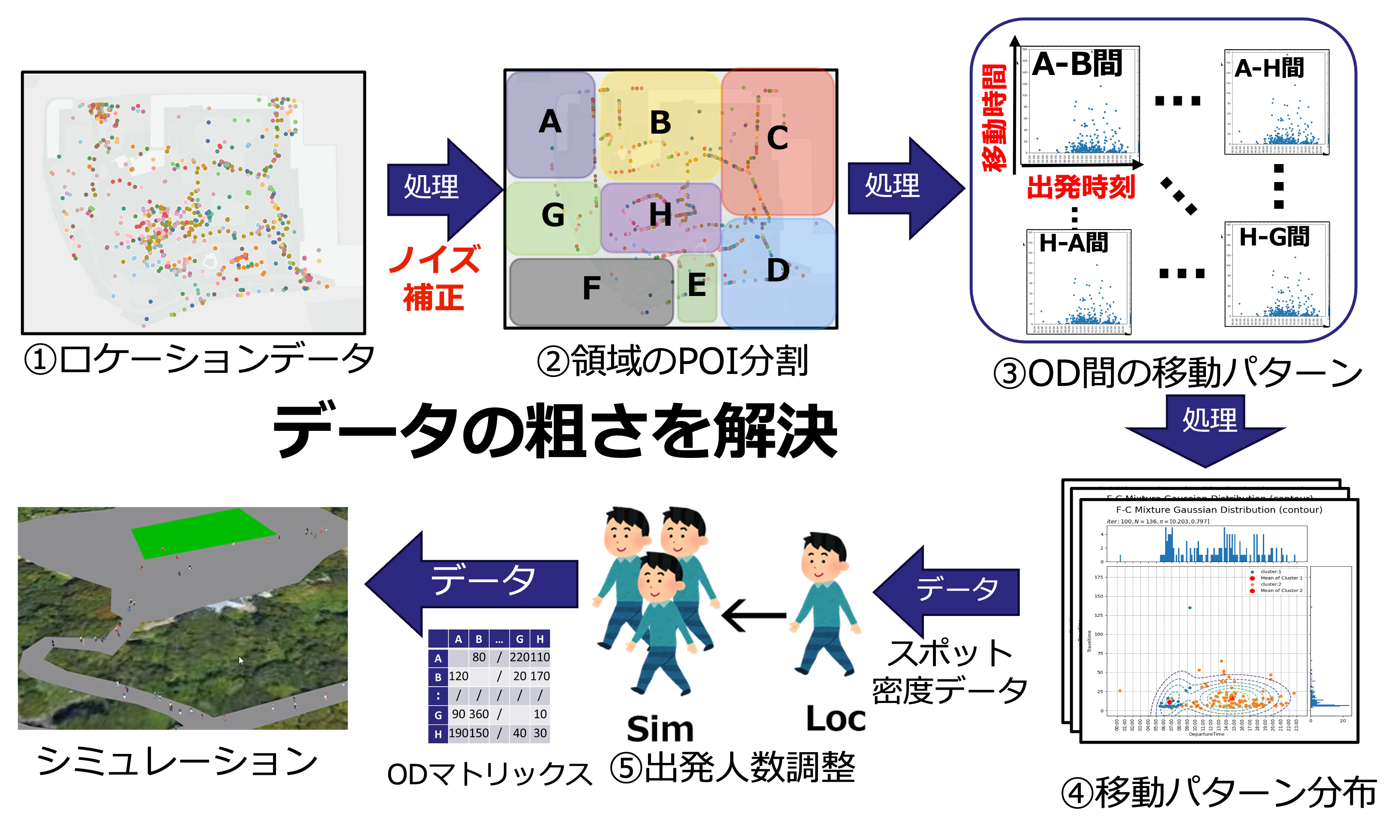
Synthesis of Pedestrian Movement Patterns: Combining Sparse Location Data with Multi-Spot Density Measurements
GPS,OD estimation

A Vehicle Tracking Method Based on Distance Estimation Using Dashboard Camera
Onboard Camera Video, Mobility Data, Vehicle Detection, Deep Neural Network(DNN)

Light-weight Object Detection of 3-D Point Cloud Data by Micro-size LiDAR
3D point cloud, object detection, LiDAR, wearable device

Privacy-preserving Pedestrian Tracking using Distributed 3D LiDARs
Privacy-preserving, LiDAR, Re-ID, Multi-LiDAR Tracking

Multi-Lane Detection and Tracking Using Vision for Traffic Situation Awareness
In-vehicle Camera, Driver Assist System

Robust Pedestrian Tracking Against Occlusions in Public Spaces Using 3D Point Clouds from Depth/LiDAR Sensors
LIDAR, Dpeth-camera, Pedestrian Tracking, Kalman-filter
Disaster Prevention・Mitigation/Smart Community
We are conducting research on disaster prevention and mitigation technologies using information communication and sensing technologies. Every year in Japan, torrential rains and typhoons cause flooding, which results in a lot of damage. When damage occurs, what is important is how quickly and correctly we can assess the damage. The more quickly and accurately we can assess the situation, the less time it will take to rescue people, and the more accurately we can allocate limited resources such as people and equipment. Currently, however, it takes a long time to assess the damage in detail, and when people are dispatched, secondary damage and human costs are incurred. In response to this, we are conducting research on the use of drones to efficiently assess the situation during a disaster.

Victim Detection Based on Shape Features from 3D Point Clouds
Drone, LiDAR, Victim Detection

Anomaly Detection of Building Structure from Incomplete Point Cloud Obtained by UAV
Point Cloud, Unmanned Aerial Vehicle, Earthquake Assessments

Drone-based water level detection in flood disasters
Drone, Flood, water level detection
Smart Home
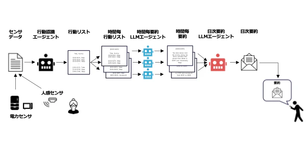
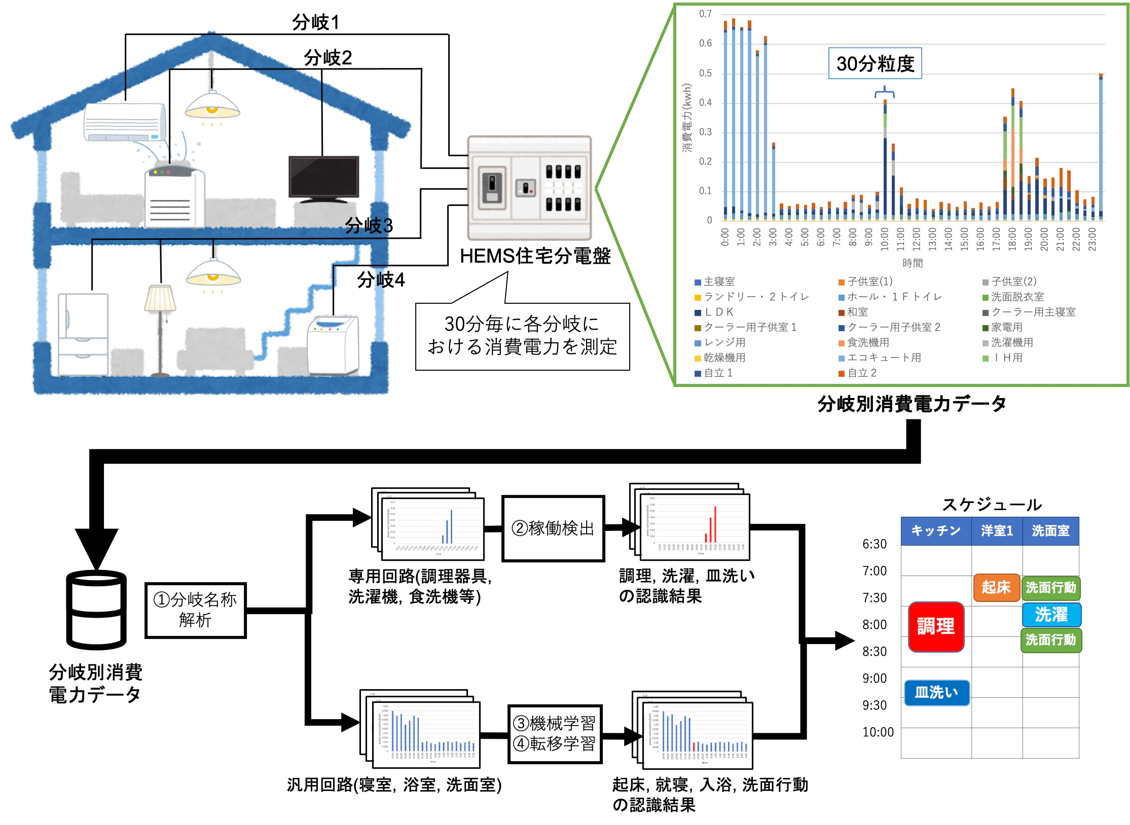
We are conducting research on achieving energy conservation and improving quality of life in households without imposing any burden on residents by installing various sensors to monitor their activities. Our work focuses on developing methods to interpret resident behavior from ambiguous sensor data, such as motion sensors, and establishing a framework for determining acceptable behavior patterns based on the analysis of collected sensor data.

Collaborative LLM Agents for Daily Activity Summarization on Edge Devices
LLM,Monitoring

LLM as Personable Decision-Making Model for Smart Home Simulation
Large Language Models, Agent-Based Modeling, Smart Home Simulation, Digital Twin, Cyber-Physical Systems

Home Activity Recognition Using Low-Grain Branch Circuit Power Consumption
HEMS, branch circuit, home activity recognition
Digital Twin
We are engaged in research on "Digital Twin" technology, which aims to replicate all people and objects in the real world in a virtual space in real time. This allows for simulations and analyses within the virtual environment, with the results being fed back into the real world.

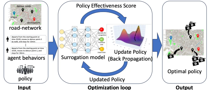
Policy Optimization for Pedestrian Traffic Management by Surrogation of Simulation Models
traffic management, multi-agent simulation, gradient descent, policy optimization

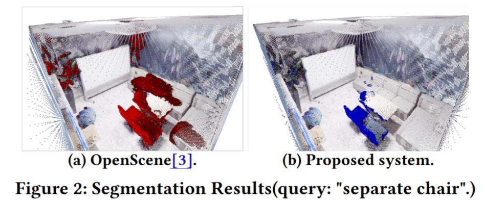
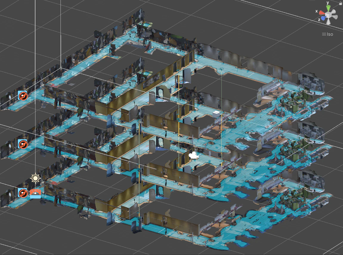
Adaptive Indoor Navigation System Using Human Flow Digital Twin
Digital twin, LiDAR, scaniverse

A Method for Synthesizing Vehicle Mobility in Urban Areas Using Traffic Surveillance Cameras
Synthetic mobility, OD traffic optimization, Traffic simulation

Smartphone User Identification in Cyber-phsyical Space
Cyber-physical Space, User Identification, LiDAR
研究テーマ一覧